12 Ancient Ring Forts in Ireland to visit
How many ring forts in Ireland? At one point in time, it is believed that there were around 50,000 Irish ring forts, but over time many have been destroyed and their stones used to build other things. There are several Ring Forts that you can still visit however and these ancient ruins should be part of any Irish road trip. These 12 Ring Forts are some of Ireland’s off the beaten path secrets.
What are Irish Ring Forts?
Ring Forts are circular fortified settlements that have various names including ráth, Fairy Forts, Dun, lios, Cashel, caher or cahir. Essentially these ring forts are rounded or oval spaces surrounded by an earth bank where the earth comes from a ditch surrounding the ring fort.
In some areas of Western Ireland, a massive stone wall enclosed the site in place of a bank and ditch. Both types of ring fort were built to protect farmsteads and villages more defensive than the military during the early Christian period. The building within the ring forts were usually timer houses but occasionally stone structures were built and you can see some of the remains.
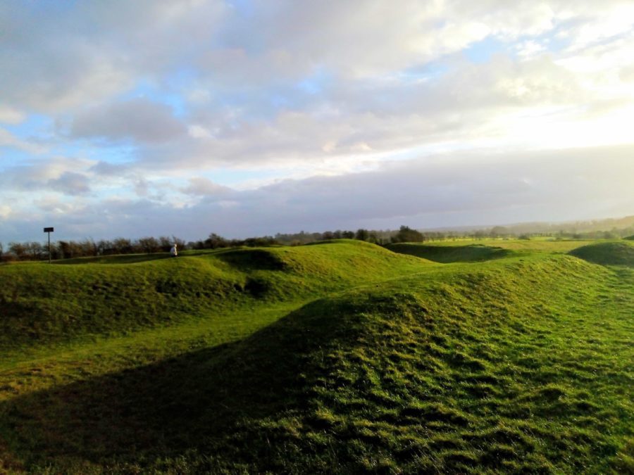
Ring Forts usually contained souterrains dating to the early medieval period, which are underground passages or chambers. The underground chambers were used as escape routes in case of an attack and a place to conceal any valuables and provide storage for food and animals.
An example of a hillfort that became a Norman stronghold would be the Rock of Dunamase, which was being used as a hillfort in the 9th Century, but when the Norman barons invaded Ireland it was converted to a defensive Castle.
- 12 Ancient Ring Forts in Ireland to visit
- What are Irish Ring Forts?
- The Hill of Tara
- Rathgall Hillfort, Wicklow
- Cahercommaun, Clare
- Grianán of Aileach, Donegal
- Doonconor Carrownlisheen, Galway
- Knockdrum Stone Fort, Cork
- Staigue Ring Fort
- Leacanabuile, Kerry
- Cahergall Ring Fort, Kerry
- Mountsandel Fort, Derry, Northern Ireland
- Dunbeg Hill Fort, Dingle Peninsula
- Emain Macha, Navan Hill Fort, Armagh, Northern Ireland
- What are Irish Ring Forts?
The Hill of Tara
The Hill of Tara is well-known as the seat of the High Kings of Ireland. More than 140 kings have reigned over the country atop the Hill of Tara.
There was a massive fort located on top of the hill. The fort is an Iron Age fort, roughly 1000m in circumference, known as the Royal Enclosure. The fort contained several earthworks including two connected ringforts referred to as the Forradh (or Royal Seat) and the Teach Chormaic (or Cormac’s House).
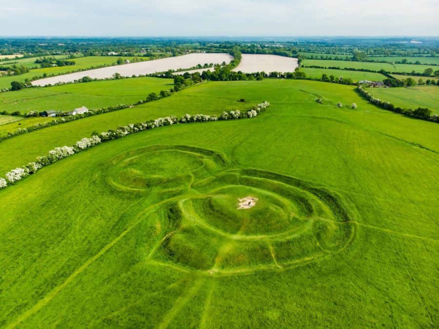
In the centre of the Forradh is where the Stone of Destiny is located. The Stone of Destiny is a large standing stone where the High Kings were believed to receive crowning. According to the myth, if the king successfully completed a series of challenges, the stone would let out a scream when the king touched it. The legend suggests this sound was heard all across Ireland.
Rathgall Hillfort, Wicklow
The Rathgall Ring is one of the largest Ring Forts in Ireland and is located near Shillelagh County Wicklow off the Tullow road, about 6 km east of Tullow. This stone rampart is built from limestone boulders which enclose an enormous oval-shaped site.
The Hill Fort has four concentric stone walls and covers an area of 18 acres and has extensive panoramic views. Excavations began at the hill fort in 1969 and revealed important finds including evidence of a house and metal workshops for casting bronze weapons and tools. Other finds included glass beads, clay moulds, bronze objects and gold beads.
Cahercommaun, Clare
Cahercommaun is a triple stone ringfort in County Clare, Ireland. It was built on the edge of a cliff around 800 AD. 16,500 tons of stone had been used to build the inner wall alone.
The excavation of the ring fort uncovered one of the most important Iron Age collections found in Ireland. From the collection, a set of sheep shears and a saddle quern are on loan to the Clare Museum from the Irish Antiquities Division of the National Museum of Ireland.
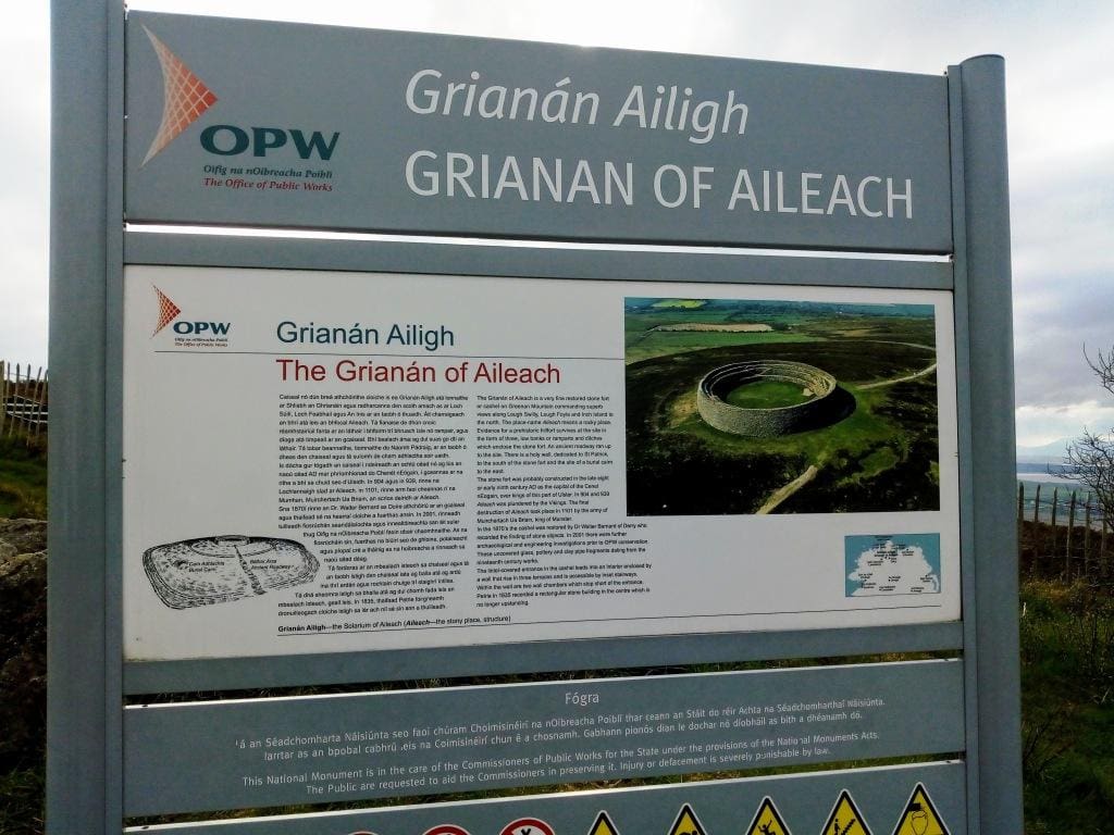
Grianán of Aileach, Donegal
Grianán of Aileach is probably the best-known monument in Inishowen, County Donegal. Situated on a hilltop 250m above sea level the view from the stone fort of Aileach is breathtaking.
From this viewpoint, you can see the entire peninsula with Lough Foyle and Lough Swilly glistening in the light.
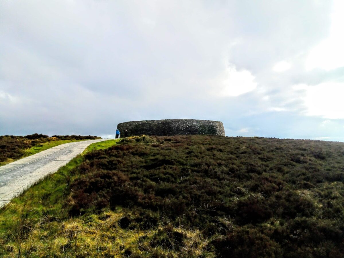
Situated around 10 miles from the town of Burt this ring fort dates back to around 1700BC. It is linked to the ancient Tuatha de Danann who worshipped Dagda the Good God who was said to have ordered the building of this stone fort as a monument to his dead son.
It is thought that St Patrick visited the site in the 5th century and baptised the local chieftain, Eoghan here.
The fort is open to the public, and there is no entry fee. The car park is located at the base of the ring fort and the grounds have been managed so that the path upwards to the fort is not treacherous.
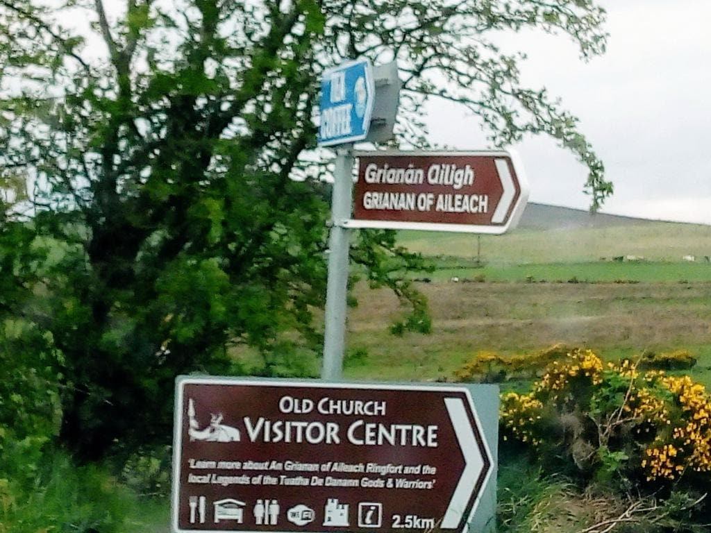
You can easily walk up to and all around the ring fort. There is a series of small terraces within the fort which are connected by a series of stairs.
Doonconor Carrownlisheen, Galway
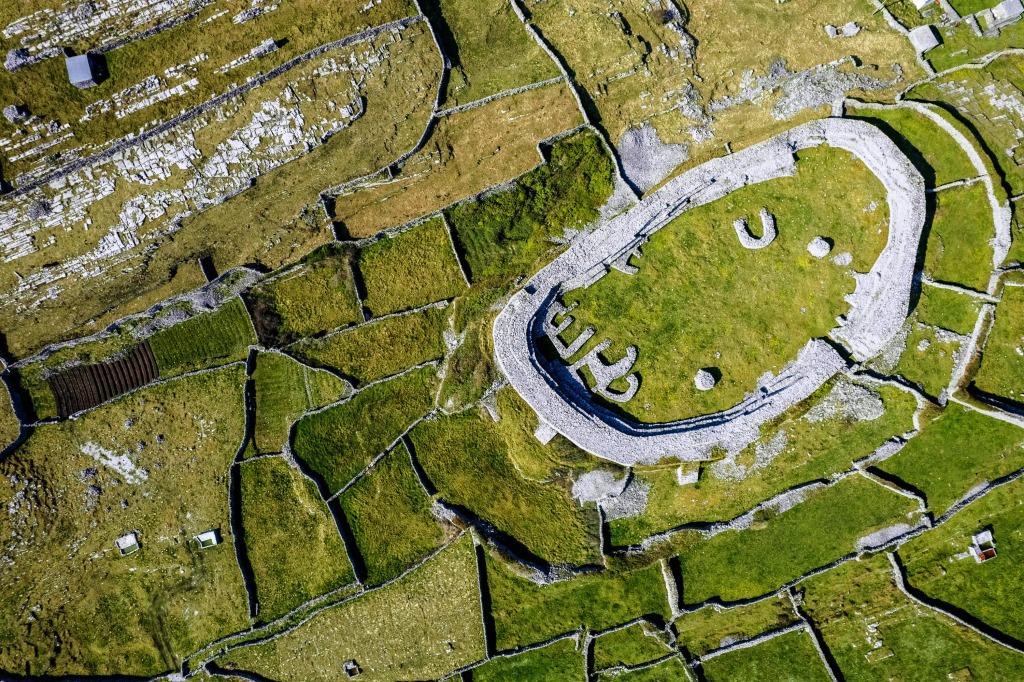
Dún Conor is a stone ringfort and National Monument located in Inishmaan, Ireland, measuring about 69 m N-S and 35 m E-W; although smaller than Dún Aengus, it has thicker walls, up to 6 m in places. The fort is believed to date back to the first or second millennium BC.
Knockdrum Stone Fort, Cork
This is one of the largest and finest stone forts in Ireland and was probably built in the early centuries AD before Christianity came. Approximately 29 metres in diameter the fort has thick walls some 3 metres wide and stands almost 2 metres high. Access to the fort is through a narrow entrance on the northeastern side of the walls. The site is owned by the Irish Government which has declared it a national monument.
Staigue Ring Fort
Off the main Sneem Waterville road on the Ring of Kerry by about 13 km lies the Staigue Fort. This is one of the finest ring fort ruins in Ireland. It’s located on a low hill with amazing views of Kenmare Bay. The fort has a massive circular rampart and the wall is up to 18 feet or 5.5 metres high and 13 ft thick it circumscribes a 90 ft diameter circular area.
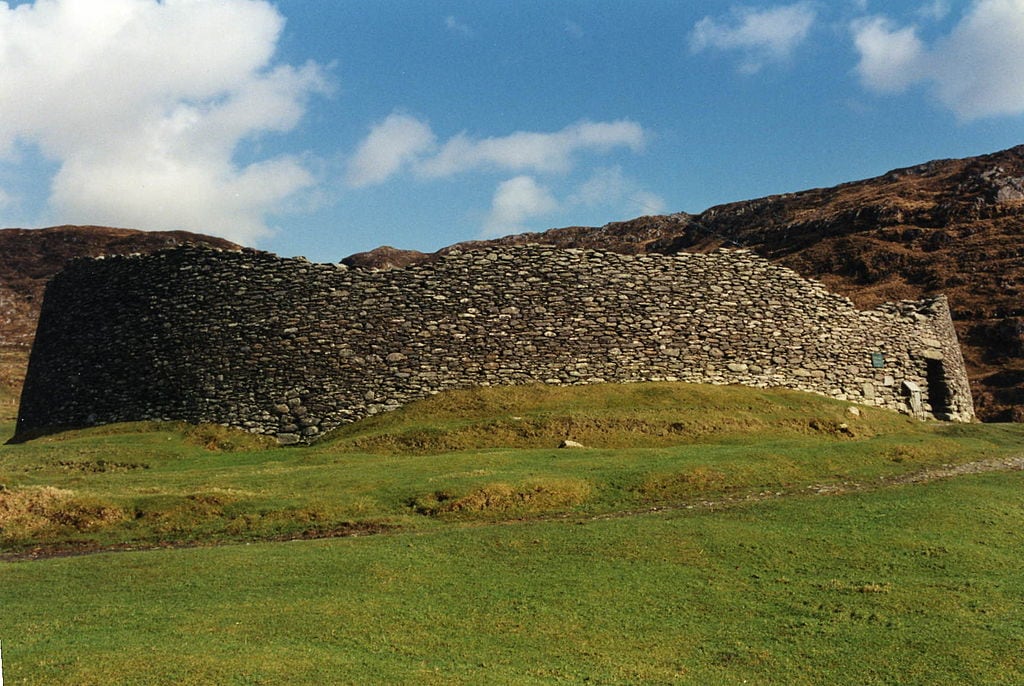
It is believed to have been built during the Celtic period and one of its outstanding features is a flight of 10 steps that are built in an X shape leading to the top of the ramparts.
Inside the walls are the remains of a roundhouse that is attached to a square building of later origin, the roundhouse is an entrance to a souterrain. Excavations have turned up whetstones and iron knives, grinding stones for barley and bone hair combs.
Excavations done inside the fort found items such as iron knives, whetstones to sharpen them with, pins and bone hair combs, and millstones for grinding wheat or barley into flour. Such objects suggest the existence of an early Christian farming community in this area.
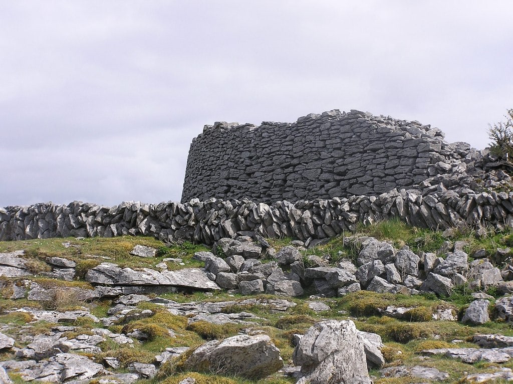
Leacanabuile, Kerry
Along the Ring of Kerry, you will see two stone forts Leacanabuile and Cahergal these are located close to Casiverheen. Both hill forts are free to enter.
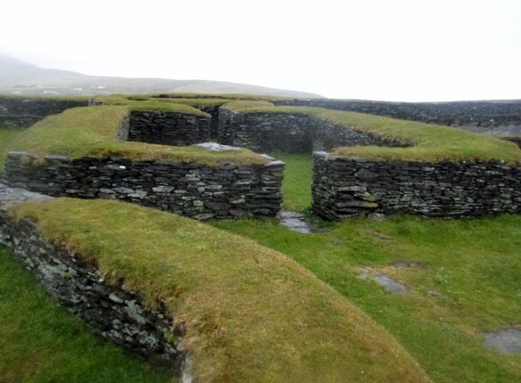
The stone fort of Leacanabuaile Stone Fort is on the hillside. It is a fine, partly-reconstructed stone fort on a massive rock foundation, its stone walls enclosing an almost circular area 70 feet in diameter. Protected on three sides by steep grassy slopes, the entrance is on the eastern side. The walls, mostly 10 feet thick and with irregular steps leading up on the inside, contain the remnants of a square dwelling house built on top of earlier circular ones; another clochan on the western side has a cavity leading to a long souterrain. Excavation produced Iron and Bronze Age objects, suggesting the existence of an early Christian farming community.
Cahergall Ring Fort, Kerry
Cahergall ringfort was built around 600 AD and is one of the best examples of an early medieval stone fort on the Ring of Kerry and was probably created for a wealthy landowning Lord. The circular wall is more than three metres thick and was built by making two strong wall faces and then filling the space between them with smaller stones. As in Staigue Fort, there are also stairs on the insides of the walls to give access to the top and a view across the countryside.
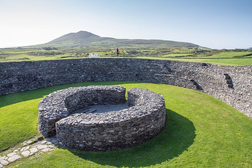
From atop the walls, you get astounding views across to Ballycarbey Castle, and the harbour in the distance.
Mountsandel Fort, Derry, Northern Ireland
The Mountsandel Fort is a prehistoric fort dating from the Mesolithic period, located in Coleraine, County Derry, this fort is a gigantic grassy mound dug into the centre of the fort, overlooking the River Bann.
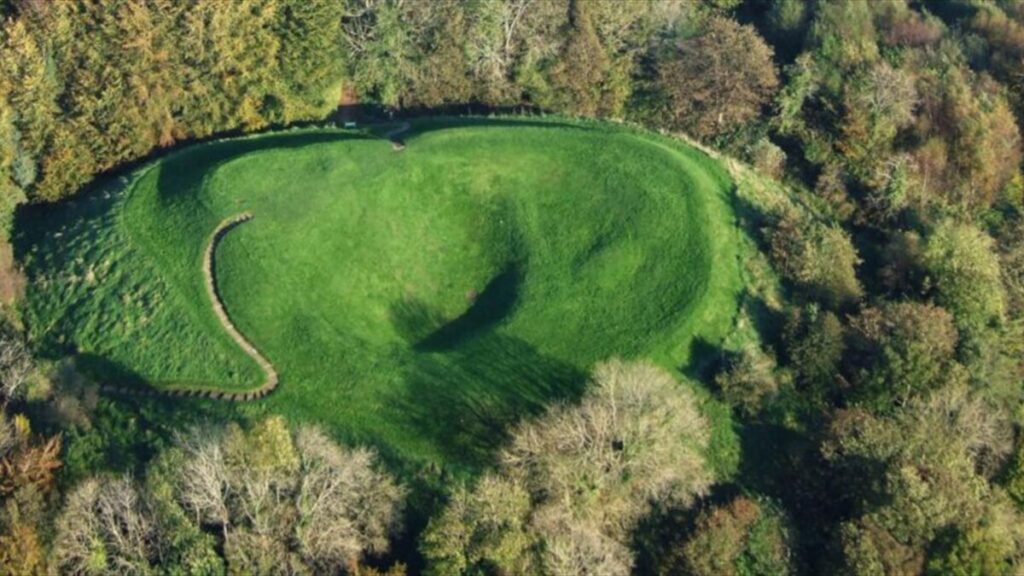
Mountsandel Hill Fort is an earthwork located on the bank of the river and resembles a hill hollowed out at the top. The fort is surrounded by a deep defensive ditch, dating from the 12th century and houses were found here that date back 7000 years along with animal bones and carved flints which are now on display at the Ulster Museum.
Dún Aonghasa, Galway
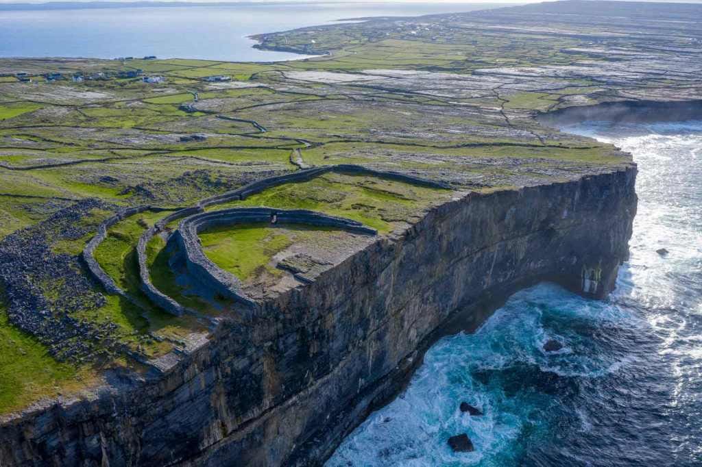
Often featured in iconic photographs of Ireland Dún Aonghasa, on the Aran Islands is a ring fort with half of it falling into the sea. The legend of Dun Aonghasa is that it was built by the ancient Irish in the 2nd century but excavations have revealed it dates back to the Bronze Age or 1100 BC.
Dunbeg Hill Fort, Dingle Peninsula
Just as dramatic a location as Dun Aonghasa Dún Beag fort is a small but impressive and elaborate example of a promontory fort on the Dingle Peninsula
Built on a sheer cliff which projects South into Dingle Bay at the base of Mount Eagle, its archaeological excavation took place in the late 1970s.
The inside of the hill fort contains the remains of a souterrain that leads to an earthen defence and a large stone house. There are four ditches of fosses and five mounds that make up the entirety of the Ring Fort.
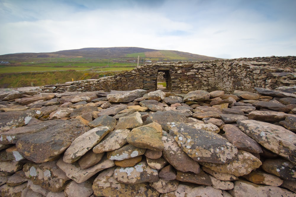
In January 2014, a storm resulted in the southern side of the entrance through the rampart collapsing causing a section to fall away close to the passageway through the stone rampart.
The CHERISH Project began early in 2017 and has been recording the latest changes with regular drone and laser scanner surveys. In December 2017, the site had to be closed again after flash flooding down Mount Eagle caused stream erosion within the fort causeway, banks and ditches.
Then during Storm Eleanor on 3rd January 2018, most of the covered entrance through the rampart and the ground below collapsed into the sea. The last covered area of this entrance collapsed in April 2019. You can now visit the Fort and take advantage of the Visitors Centre for information and a lovely café.
Emain Macha, Navan Hill Fort, Armagh, Northern Ireland
Emain Macha, which was said to be the traditional seat of the kings of Ulster and the capital of the Ulstermen the Navan Hill Fort, is an enclosure approximately two miles west of the city of Armagh. This monument, measuring 236 meters across, is situated on a small hill and is surrounded by several other prehistoric sites, including Haughey’s Fort, a late Bronze Age hillfort; and the King’s Stables, an artificial pond created circa 1000 BC.
The site was initially occupied in the Neolithic period, and then again during the Bronze Age. A small enclosure was surrounded by a wide shallow ditch and a row of timber uprights.
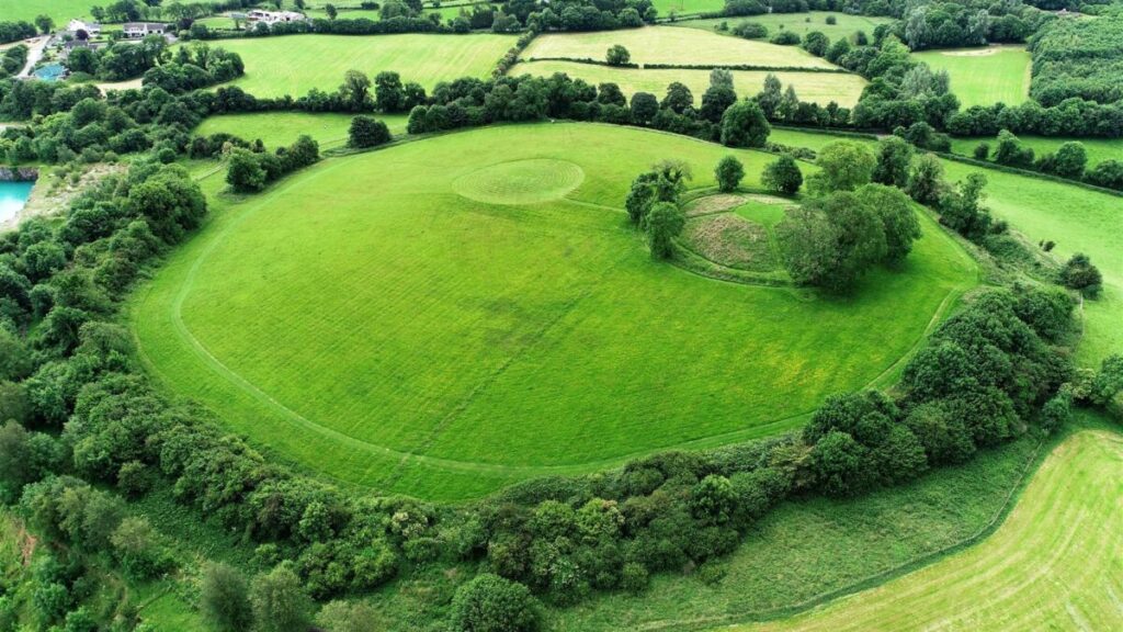
The interior of the enclosure was occupied by a figure-eight structure that was renewed on a number of occasions; the skull of an ape, imported from North Africa, was found in one of the wall slots.
Emain Macha has been traditionally interpreted as a royal site along with Tara, Knockaulin, and Rathcroghan, and the archaeological evidence suggests that all of these sites were major ritual centres during the Iron Age.
Irish ring forts are an important part of Ireland’s history and culture. They were built in defensive positions and had many uses over the centuries. Today, you can still find these fascinating structures dotting the Irish landscape, reminding us of our past and providing a glimpse into how people lived in ancient times.
Pin it to save it
