
Killybegs, County Donegal: The Complete Guide to Ireland’s Greatest Fishing Port
What is Killybegs? Killybegs is a coastal town in County Donegal, Ireland, home to the country’s largest and deepest fishing harbour. Located on the Wild Atlantic Way approximately 30 kilometres west of Donegal Town, it combines a rich maritime culture, Irish folklore, a walkable heritage trail, excellent seafood restaurants, and easy access to Slieve League, Europe’s highest sea cliffs. Population: approximately 1,500. Harbour depth: one of the deepest natural harbours on the Irish Atlantic coast. Nearest airport: Donegal Airport, approximately 45 kilometres north.

Why Killybegs Belongs on Every Ireland Itinerary
Drive west from Donegal Town along the N56 and you will reach Killybegs in about 30 minutes. The moment the harbour comes into view, with its fleet of trawlers and the deep blue of the bay beyond, you understand why this place has been pulling people in for centuries. I live just down the road, and it is where I go when I want to eat well, breathe salt air, and remember how extraordinary the ordinary can be.
Killybegs operates Ireland’s largest fishing port, sits inside one of the deepest natural harbours on the entire Atlantic coast, and carries a heritage trail covering everything from prehistoric ring forts to Spanish Armada shipwrecks and hand-knotted carpets that once graced the floors of Buckingham Palace. Cruise ships anchor here during the summer season, and for good reason.
Whether you are arriving on a cruise with a few hours ashore, touring the Wild Atlantic Way by car, or looking for a base from which to explore Donegal’s remarkable coastline, this guide covers everything you need. It is written by someone who has taken visitors and friends here more times than she can count.
- Killybegs, County Donegal: The Complete Guide to Ireland's Greatest Fishing Port
- Why Killybegs Belongs on Every Ireland Itinerary
- Fast Facts
- What is Killybegs and Where Exactly is It?
- The Killybegs Heritage Trail: A Guide to Every Stop
- Killybegs Boat Tours
- How to Plan Your Visit to Killybegs: Step by Step
- Where to Eat in Killybegs: Tried and Tested Local Recommendations
- What to See Near Killybegs: Day Trips Along the Wild Atlantic Way
- Frequently Asked Questions About Killybegs
- Thoughts on Killybegs, County Donegal
- Exploring the fascinating regions of Ireland
Fast Facts
| Location | Killybegs Bay, south coast of County Donegal, northwest Ireland |
| Irish name | Na Cealla Beaga (the little cells) |
| Population | Approximately 1,500 |
| Harbour | Ireland’s largest fishing port; one of the deepest natural harbours on the Atlantic coast |
| Distance from Donegal Town | Approximately 30 km west via the N56 |
| Distance from Slieve League | Approximately 19 km (25 to 30 minute drive) |
| Slieve League height | 601 metres (1,972 feet) — nearly three times the height of the Cliffs of Moher |
| Key heritage sites | St Kit’s Castle (1355), St Catherine’s Holy Well, Niall Mor grave slab (1524) |
| Notable history | Spanish Armada (1588), Grace O’Malley raid (1513), Donegal Carpet Factory (closed 2003) |
| Carpet legacy | Donegal carpets still in Buckingham Palace, the White House, and the Vatican |
| Best time to visit | June to September for boat tours, festivals, and lifeguard cover at beaches |
| On the Wild Atlantic Way | Yes — signposted route along the N56 from Donegal Town |
What is Killybegs and Where Exactly is It?
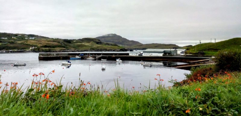
Killybegs is a working fishing town and harbour on the south coast of County Donegal in northwest Ireland. It sits at the head of Killybegs Bay, a sheltered inlet of Donegal Bay, on the route officially designated as the Wild Atlantic Way.
The name derives from the Irish Na Cealla Beaga, meaning the little cells, a reference to the small stone dwellings built by early Christian monks who settled in the area. Those same monks dedicated a holy well to St Catherine of Alexandria, patron saint of seafarers, setting a spiritual tone for a town that would become synonymous with the sea for the next fifteen centuries.
The area has been inhabited since prehistoric times. Archaeological evidence of as many as 20 ring forts has been found near the harbour, and Christianity arrived in the 6th century with St Colmcille, who later moved on to found the settlement now known as Glencolmcille. From those early monastic beginnings, Killybegs grew into the maritime powerhouse it remains today.
The Killybegs Heritage Trail: A Guide to Every Stop
Killybegs has a well-organised heritage trail that you can cover in a comfortable morning or afternoon on foot. Below are the key stops in the order you will encounter them arriving from the N56.
The Clochan Huts
As you drive into town you will spot two beehive-shaped stone structures beside the road. These are reproduction Clochan huts, round dry-stone dwellings built without mortar that were common across early Irish monastic settlements. They echo the little cells that gave Killybegs its name and they are a quiet, effective introduction to how ancient this landscape really is.
Personal note: I have driven past these hundreds of times and still find myself slowing down to look. They are a small thing that earns a moment of your attention.


St Catherine’s Holy Well
At the edge of town stands a holy well dedicated to St Catherine of Alexandria. The legend attached to it is one of the finest examples of Irish folklore connected to the sea: three monks were washed ashore after a violent storm and promised to build a well in the saint’s honour if they survived. They kept their word. The well has been a place of pilgrimage and quiet reflection ever since, and it connects the maritime culture of Killybegs to its deepest spiritual roots.


St Kit’s Castle and the Ruined Church
Directly above the well stand the National Monument ruins of St Kit’s Castle, built in 1355 as the residence of Bishop Padraig Mac Maonghaill of Killybegs, who died in 1367. Historians believe the castle originally stood three storeys high with its entrance on the west side. Beside it are the ruins of the 12th-century St Catherine’s Church and graveyard, a layered site spanning nearly a thousand years of local history in one compact view.
According to the Annals of the Four Masters, the pirate queen Grace O’Malley from County Mayo attacked Killybegs in 1513 while the men of the village were away fighting. The town was the chief port of Tir Chonaill in the 16th century, and the O’Donnell chieftains were described by contemporaries as the best lords of fish in Ireland.

The Spanish Armada and the Girona
In 1588, three ships from the Spanish Armada sought refuge in Killybegs harbour, including the Girona. MacSweeney Bannagh, a local chieftain, helped feed the sailors and repair the ship’s rudder before it set sail for Scotland. The Girona was subsequently wrecked off the coast and all 1,300 people on board were lost. It is one of the most devastating episodes in Donegal’s recorded history. Artefacts from the Girona are now displayed in the Ulster Museum in Belfast.

The Niall Mor Grave Slab
Inside St Mary’s Church, set against the west wall, rests an ornate carved grave slab belonging to Niall Mor Mac Suibhne, chief of his clan, who died peacefully in 1524. The slab was originally at the Franciscan Friary at Ballysaggart on St John’s Point and was moved to Killybegs in 1868. Enter through the small gate and descend the steps to find it to the left of the main door. It is genuinely unusual and well worth seeking out.

St Mary’s Church
The Church of St Mary of the Visitation was dedicated by the Archbishop of Dublin in 1854. Three stained glass windows in the chancel are its outstanding feature: the centre depicts St Catherine of Siena, the left the Mother of God, and the right St Catherine of Alexandria, the town’s patroness. These were added approximately 20 years after the church’s dedication and the quality of the glasswork is striking.

The Robertson School
Built in 1819, the Robertson School was the first school in the area. The teacher and his family lived on the ground floor, with classrooms upstairs. It is now a private home and sits quietly on the streetscape as a reminder that education arrived in this small Atlantic fishing town remarkably early.
Personal note: This is one of my favourite buildings in Killybegs. Most visitors walk straight past it. The conviction it represents — that this community was worth educating, two centuries ago on the Atlantic edge — moves me every time.

Killybegs International Carpet Making and Fishing Centre
Killybegs was once world-famous for its hand-knotted Turkish-style carpets, produced at the Donegal Carpet Factory on what was reportedly the world’s largest carpet loom. Examples of these extraordinary textiles still lie on the floors of Buckingham Palace, the White House, and the Vatican.
The factory closed in 2003 and the building now houses the Killybegs International Carpet Making and Fishing Centre, which offers guided tours covering both industries. A modern ship simulator lets visitors test their navigation skills — children find it genuinely exciting and adults find it more difficult than they expect.
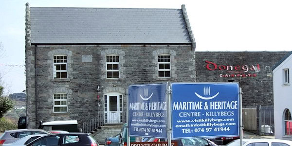
Killybegs Coastguard Station
The Coastguard Station was built in 1875. When the British Coastguards withdrew from the Irish Free State in 1922, their 109 stations passed to the Provisional Government along with the lifesaving and rocket apparatus. Some were damaged during the Civil War. The Killybegs station was eventually sold and converted to a private residence, as happened with several others along the coast.

Killybegs Information Centre
Located on Shore Road, the Information Centre is the practical starting point for visitors. Staff provide detailed descriptions of local attractions and free maps covering the looped walking routes around town. Stop here first if you are arriving without a plan.
Killybegs Boat Tours
Killybegs Harbour Tour
Killybegs Harbour Tour is a 1.5 hours cruise that provides a behind the scenes look at this historic and industrious fishing port. As you glide through the sheltered waters of the harbour, you will see towering commercial trawlers, traditional wooden boats and modern vessels being serviced in the town’s renowned dry docks. The company also does fishing trips and wildlife tours.
Killybegs Atlantic Coastal Cruises
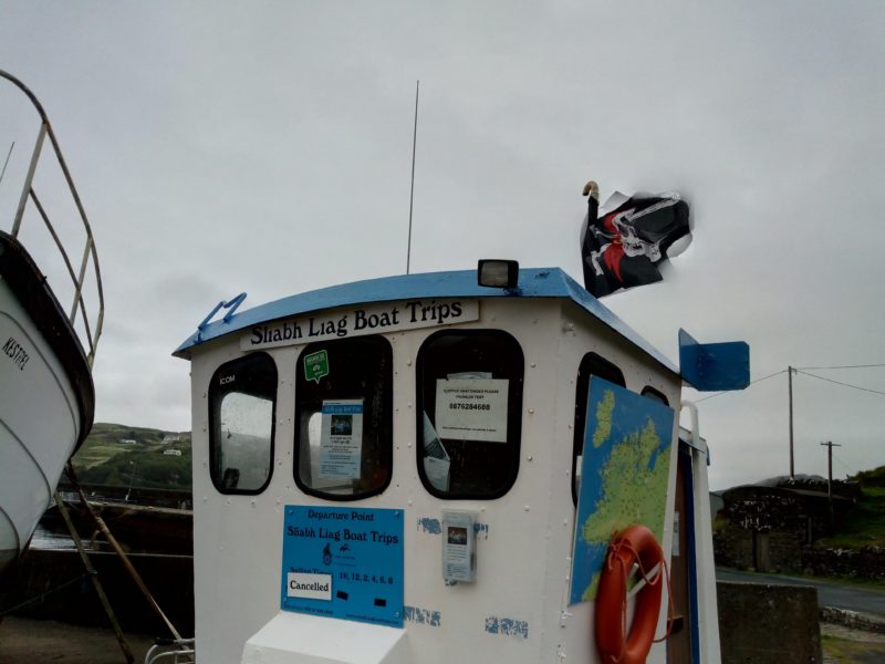
The ship travels from Killybegs Harbour out to the base of the Sliabh Liag cliffs. Straight away you will experience the individual landscape of Donegal Bay, as Killybegs Harbour uniquely has two lighthouses. At almost 600m, Sliabh Liag boasts Europe’s highest accessible sea cliffs, and the best place to truly appreciate their magnificence is from the sea. You will see the Napoleonic Tower on the cliff top as we sail past numerous sea stacks and sheltered coves, caves and waterfalls, all holding their own history and secrets.


Keep your eyes open for dolphins, grey seals, bluefin tuna, basking sharks, and a rich variety of seabirds. The harbour and coastline tour also passes Rotten Island Lighthouse, built in 1838 and still operational, and St John’s Point Lighthouse, constructed in 1831. You can book overnight stays in the lighthouse keeper’s cottages at St John’s Point, which is one of the more memorable accommodation options on this stretch of coast.

How to Plan Your Visit to Killybegs: Step by Step
Drive in on the N56 from Donegal Town, approximately 30 kilometres. The Clochan huts appear on your left as you approach town and signal that you have arrived.
Park near the harbour front. Walk the main street first to get your bearings and collect a walking map from the Killybegs Information Centre on Shore Road.

Cover the heritage trail in the morning: St Catherine’s Well, St Kit’s Castle, the ruined church, and St Mary’s Church to see the Niall Mor grave slab.

Stop for lunch at Ahoy Cafe for harbour views, Mrs B’s for excellent baking, or the Seafood Shack for fresh fish on the waterfront.
Visit the Killybegs International Carpet Making and Fishing Centre in the afternoon. Allow an hour, more if children are with you.
Book the Pirate Queen boat tour in advance, particularly during the summer cruise season when spaces fill quickly.
Allow extra time if you plan to continue to Fintra Beach, Kilcar, or Slieve League. All are within 20 kilometres and each deserves unhurried time.
Where to Eat in Killybegs: Tried and Tested Local Recommendations
Killybegs has a food scene that consistently outperforms its size. Fish landed at the port that morning ends up on your plate the same evening. These are the places I return to regularly, and where I take every visitor I bring here.
Ahoy Cafe
On the main road with direct views of the fishing boats and, during the cruise season, the ships at anchor in the bay, Ahoy Cafe has a lovely outdoor terrace that is perfect for people-watching on a bright Donegal day. The food is excellent and unpretentious. Brunch here on a sunny morning, with a coffee and a view of the water, is one of the simple pleasures of this stretch of coast.


Mrs B’s
On the Main Street behind the harbour road, Mrs B’s has built a quiet reputation for outstanding baking, good coffee, and hearty homemade food. There are outdoor tables in summer, a pretty interior, and staff who make you feel genuinely welcome. It is the kind of cafe that a town this size should have but often does not.


Seafood Shack
Right on the harbour front and impossible to miss, the Seafood Shack is a street food truck serving some of the freshest fish you will eat anywhere in Ireland. The chowder has won awards. The calamari is properly cooked. The fish and chips is made with fish that was in the water that morning. When the Shack is closed for the season, those of us who live nearby miss it acutely.
Personal note: On a warm July afternoon with a bowl of chowder and a view of the boats, there are few better places to be in Donegal.


Anderson’s Boat House Restaurant
The Boat House was created by the team behind the Seafood Shack. The focus is on the freshest local seafood, tender Irish steaks, and well-sourced poultry. There is a cobblestone courtyard for outdoor dining with local craft beers, Irish whiskey, and gin. It is a grown-up, unhurried dining experience that shows what Killybegs food can do at its most ambitious.

What to See Near Killybegs: Day Trips Along the Wild Atlantic Way
Killybegs is an ideal base for exploring the western coast of Donegal. If you have arrived by cruise ship with limited time, prioritise Slieve League. If you have a car and a few days, the drive westward from Killybegs is among the finest in Ireland and the Wild Atlantic Way signage keeps you on the right route throughout.
Fintra Beach
Fintra, or Fintragh, Beach is one of the finest beaches in a county already blessed with exceptional coastline. It is a Blue Flag beach on the outskirts of town, reached by driving down a steep hill to a small car park that opens onto a vast stretch of golden sand. Popular with locals for swimming and water sports, it has a lifeguard through the summer season. You will regularly see horses ridden along the shoreline and walkers making the most of the dunes. It is one of my favourite beaches in Donegal, which is saying something given the competition.


Largy Viewpoint and the Coastal Waterfall
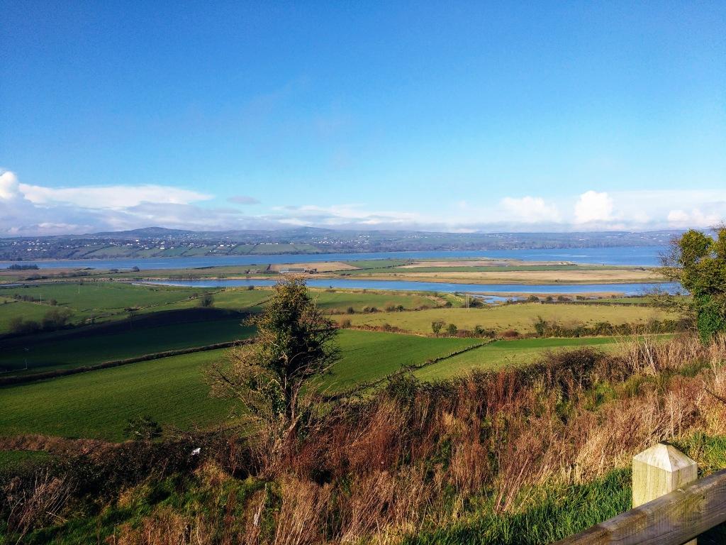
The Largy Viewpoint delivers one of the most rewarding coastal panoramas in Donegal. On a clear day you can spot dolphins in the water below and see across four counties: Mayo, Sligo, Leitrim, and Donegal. It is also the starting point for reaching a sea cave waterfall that has become considerably less secret in recent years.
Two rules apply to the waterfall visit and both are non-negotiable. Visit only at low tide: the access path floods at high tide and you can be trapped. And cross the private farmland only with the landowner’s permission. The walk involves uneven, slippery coastal terrain and is not suitable for anyone with difficulty navigating that kind of ground.
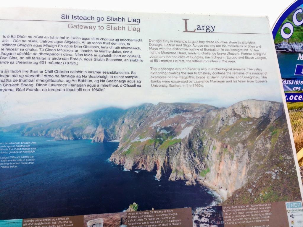

Muckross Head Peninsula
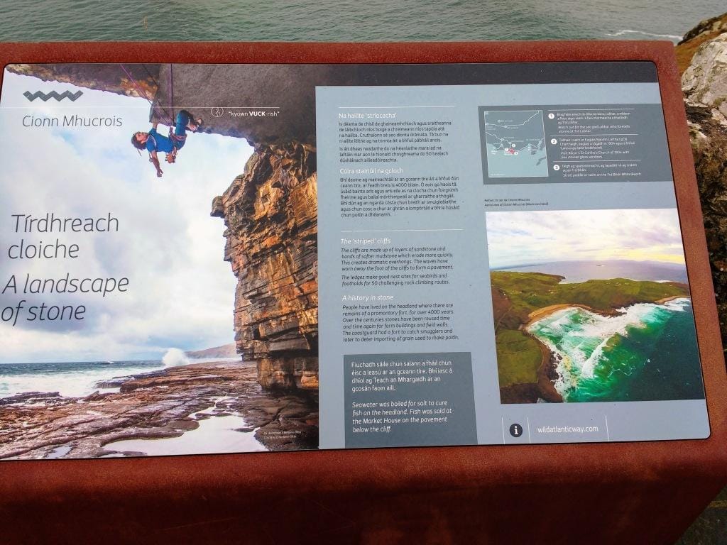
Follow Google Maps directions to Muckross Head on your way towards Kilcar. There is a free car park at the end of the peninsula and several footpaths leading to dramatic cliff edges. The rock is horizontally layered sandstone interspersed with mudstone that has eroded to create the overhangs that make Muckross a celebrated climbing destination. There are two beaches: Tra na nGlor, a surfing beach with a rip tide that demands care, and Tra Ban, a safe family swimming beach.

Kilcar Village and Studio Donegal
Kilcar is a small village in the Donegal Gaeltacht with views that stop you in your tracks. Make a stop at Studio Donegal, a family-run hand-weaving business open to visitors Monday to Friday, free of charge. The factory shop sells tweed throws, Donegal Yarns wool, and traditional and contemporary knitwear. Every August bank holiday, the village hosts the Kilcar Fleadh, a traditional Irish music festival that fills the place completely.
Personal note: Kilcar is the kind of village that makes you want to stay longer than you planned. The music sessions here are the real thing, and for those fans of Sarah Jessica Parker this is where she visits often.


Teelin and the Boat Trips to Slieve League
Teelin is where you catch a boat to see Slieve League from the water. Teelin Boat Trips offers trips around the cliffs for approximately 25 euros per adult, with options for private full-day charters, diving, angling, and sunset voyages. Teelin is a Gaeltacht village with a strong reputation for traditional music and has hosted an Irish language school, Colaiste Aoidh Mhic Bhricne, since 1955.
On the way to Teelin make sure you stop at the Rusty Mackerel where you can have a fine Irish lunch and in the evenings enjoy some traditional music.

Sliabh Liag (Slieve League): Europe’s Highest Sea Cliffs
Killybegs has long been considered the gateway to Sliabh Liag. These cliffs rise to 601 metres above the Atlantic and are nearly three times the height of the Cliffs of Moher, making them the highest sea cliffs in Ireland and among the most dramatic accessible sea cliffs in Europe. The panoramic views over Donegal Bay are approximately 19 kilometres from Killybegs.

For those with a head for heights, the route called One Man’s Pass takes hikers to the highest point of the cliffs. I will be transparent: I have not walked it. The views from the lower car park and the Eagle’s Nest viewpoint are extraordinary without requiring any nerve at all. Those cliffs earn their reputation from any angle.

Slieve League is safe for most visitors who stick to the marked paths and wear sensible footwear, though the upper route known as One Man’s Pass is a narrow ridge walk with steep drops on both sides, suitable only for confident, experienced hill walkers in good weather. At 601 metres, Slieve League also stands nearly three times the height of the Cliffs of Moher, which rise to 214 metres, and while the Cliffs of Moher draw larger crowds with more visitor infrastructure, Slieve League offers a wilder, less commercialised experience where you can actually walk the cliffs rather than view them from behind a safety fence.


Frequently Asked Questions About Killybegs
| Is Killybegs worth visiting? Yes. Killybegs is one of the most rewarding stops on the Wild Atlantic Way. It combines a working fishing harbour, genuine Irish maritime culture, a heritage trail spanning a thousand years, and excellent seafood restaurants. It is not a manufactured tourist town: it is a real, working place that happens to be historically rich and scenically beautiful. Most visitors arrive uncertain what to expect and leave genuinely surprised by how much is here. |
| What is Killybegs famous for? Killybegs is famous for operating Ireland’s largest fishing port and one of the deepest natural harbours on the Atlantic coast. It is also known for the Donegal Carpet Factory, which produced hand-knotted carpets now displayed in Buckingham Palace, the White House, and the Vatican. The town has strong historical connections to the Spanish Armada, Grace O’Malley, and the O’Donnell chieftains, and it serves as the primary access point for Slieve League, Europe’s highest sea cliffs. |
| How far is Killybegs from Slieve League? Slieve League is approximately 19 kilometres (about 12 miles) west of Killybegs by road. The drive takes roughly 25 to 30 minutes and passes through some of the finest coastal scenery in Ireland, including Kilcar and the Muckross Head Peninsula. |
| Can you see cruise ships in Killybegs? Yes. Killybegs has one of the deepest natural harbours on the Atlantic coast of Ireland, which means large cruise ships can anchor there. During the summer season, seeing a cruise ship in the bay is a regular occurrence. Day visitors from cruise ships typically head directly to Slieve League, so booking local tours in advance is recommended. |
| What Irish folklore is connected to Killybegs? Killybegs has strong Irish folklore connections. The holy well dedicated to St Catherine of Alexandria rests on the legend of three monks saved from a storm at sea who fulfilled a vow to build it. The town’s Irish name, Na Cealla Beaga, preserves the memory of early monastic settlement going back to the 6th century. The 1513 raid by pirate queen Grace O’Malley and the tale of the Spanish Armada’s Girona are part of an oral and written tradition kept alive in the town to this day. |
| Is Killybegs accessible for visitors with mobility challenges? The harbour front and main street are largely flat and accessible by wheelchair or with limited mobility aids. The heritage trail includes steps and uneven ground at the holy well and ruined church, so a degree of mobility is needed for the full trail. Ahoy Cafe, Mrs B’s, the Seafood Shack, and Anderson’s Boat House are all accessible at ground level, though it is worth calling ahead to confirm. The Largy Viewpoint and coastal waterfall walk involve rough terrain and are not suitable for those with limited mobility. The Pirate Queen boat tour should be discussed directly with the operator regarding boarding access. |
| What is the best time to visit Killybegs? June through September offers the best weather and the most activity: Pirate Queen boat tours are running, the Kilcar Fleadh takes place on the August bank holiday, and Fintra Beach has lifeguard cover. That said, Killybegs is a working port year-round and a winter visit has its own appeal, with smaller crowds, dramatic Atlantic light, and the harbour at its most atmospheric. |
| What is the connection between Killybegs and the Spanish Armada? In 1588, three Spanish Armada ships sought refuge in Killybegs harbour after the failed attempt to sail around Ireland and attack Britain. Among them was the Girona. Local chieftain MacSweeney Bannagh helped feed the sailors and repair the ship’s rudder. The Girona then sailed for Scotland but was wrecked off the Antrim coast, with the loss of all 1,300 people on board. Artefacts from the Girona are now displayed in the Ulster Museum in Belfast. |


Thoughts on Killybegs, County Donegal
Killybegs is one of those places that rewards people who take their time with it. It is not trying to impress you. The boats go out, the fish comes in, and the harbour smells exactly as a working harbour should. The heritage sits quietly in the landscape and in the churches, rather than demanding your attention behind an admission desk.
Living nearby means I have watched many visitors arrive unsure what to expect and leave genuinely surprised by how much is packed into this small Atlantic town. Come for the sea cliffs at Slieve League, stay for the chowder at the Seafood Shack, and take a moment at St Catherine’s Holy Well to think about the monks who built it after surviving a storm. That is the real Killybegs.

If you’re curious about the Irish language, my guide to the Donegal Gaeltacht explains what it is, where it is, and where to learn Irish if you’re coming from abroad.
For more practical guides to Donegal and the Wild Atlantic Way, visit xyuandbeyond.com.
Join 7,500 Ireland travellers in my Ireland Uncovered Facebook Group and 1,897 on my XYUandBEYOND PAGE
Start Planning Your Trip
👉 Public Transportation in Ireland
👉 Hidden Gems in Ireland – 32 Secret places to visit
👉 Answering all your travel questions about Ireland
👉What to pack for your Ireland trip
👉 Northern Ireland Public Transportation