
Kilkee Cliffs: Walks, Map, Parking and Accessible Viewpoints
Quick answer: The Kilkee Cliff Walk starts at the Diamond Rocks Café / Pollock Holes car park in Kilkee’s West End, County Clare. Choose a 1.8 km (30 min) short walk, a 4 km loop, an 8 km loop via Moveen Hill, or an 11.7 km long route. It’s free, open all year and dog-friendly. The cliffs are lower than Moher’s 214 m (Bishop’s Island, the most famous landmark, is about 65 m high), but far quieter.
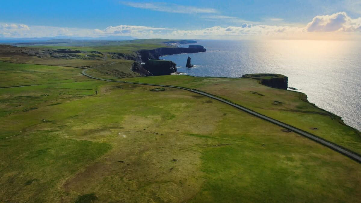
I’ve walked Slieve League, the Cliffs of Moher and the Kerry Cliffs, and each one is unique in a very Irish way. But the Kilkee Cliffs thrill my inner 12-year-old geology geek.
In grade 8 I was the kid making volcanoes, learning about the great glaciers that once covered so much of the world, finding out what a dolmen was, and studying stratification: how rock is laid down in layers, one era on top of another. At Kilkee, that lesson is right there in front of you. The cliff faces are striped with layer after layer of sandstone and shale, and you can read the history of the earth in them like the pages of a book. I stood there grinning like I was back in science class.
I have walking and mobility issues, so I didn’t do the full cliff walk. I saw the Kilkee Cliffs from the viewpoints instead: the Diamond Rocks car park, the coast road, the Bishop’s Island pull-in and out at Loop Head. Most guides assume you’ll walk the whole trail. You don’t have to, and in the accessibility section below I’ll show you exactly how to see the cliffs if walking is hard for you too.
Unlike the Cliffs of Moher, the Kilkee Cliffs are free, unfenced and quiet. You can hear yourself think over the waves. Along this stretch of the Wild Atlantic Way, sea stacks stand just offshore, and the ruins of an early monastery still sit on top of one of them.

- Kilkee Cliffs: Walks, Map, Parking and Accessible Viewpoints
- Kilkee Cliffs Fast Facts
- Kilkee Cliffs vs the Cliffs of Moher
- How High Are the Kilkee Cliffs?
- How Long Is the Kilkee Cliff Walk? Routes & Distances
- Walking Directions: How to Find the Puffing Hole, the Amphitheatre and Other Hidden Features
- Kilkee Cliffs Map
- Kilkee Cliffs Parking
- Getting to Kilkee
- The Pollock Holes: Kilkee’s Natural Swimming Pools
- Intrinsic Bay and the Wreck of the Intrinsic
- Bishop’s Island: The Monastery on a Sea Stack
- Wildlife & Birdwatching
- Kilkee Beach, the Promenade and Town
- Beyond Kilkee: Loop Head Peninsula
- Accessibility at Kilkee Cliffs: Seeing the Cliffs With Limited Mobility
- Safety & Seasonal Tips
- Things to Do in Kilkee: Food & Activities
- More of Clare and the Wild Atlantic Way
- Kilkee Cliffs FAQ
- Final Thoughts
Kilkee Cliffs Fast Facts
| Fact | Detail |
| Location | Kilkee, West Clare, on the Loop Head Peninsula (Wild Atlantic Way, “Cliff Coast” section) |
| Trailhead | Diamond Rocks Café / Pollock Holes car park, West End, Kilkee |
| Walk options | 1.8 km, 4 km, 8 km and 11.7 km (see table below) |
| Cost | Free, open year-round |
| Height | No single official figure. Bishop’s Island sea stack is about 65 m. The 214 m often quoted online is Moher’s height |
| Rock type | Upper Carboniferous (Namurian) sandstones, siltstones and shales, about 300–320 million years old |
| Accessibility | Step-free views from the car park and the coast road; tarmac path with benches, but a steep 200 m climb partway |
| Dogs | Welcome (keep on a lead near the edge) |
| Bus | Bus Éireann 333 and 336 from Ennis |
| Beach | Kilkee Beach holds a Blue Flag for 2026 (bathing season 1 June–15 September) |
| Nearby | Loop Head Lighthouse, Bridges of Ross, Cliffs of Campoy, Carrigaholt dolphin watching |
Kilkee Cliffs vs the Cliffs of Moher
The Kilkee Cliffs are quieter and more intimate than the busier Cliffs of Moher. Moher is higher and more dramatic in a single view. Kilkee gives you variety: tidal pools, a shipwreck bay, a blowhole, an island monastery and a long stretch of coast you can see without a ticket or a crowd.
| Kilkee Cliffs | Cliffs of Moher | |
| Height | Lower: Bishop’s Island about 65 m | Up to 214 m |
| Cost | Free | Paid visitor-centre admission |
| Crowds | Light, even in summer | Very busy, coach tours |
| Barriers | Largely unfenced | Fenced main viewing area |
| Extras | Pollock Holes, Blue Flag beach, Bishop’s Island | Visitor centre, O’Brien’s Tower |
If you’re driving the whole Clare coast, do both. If you only have time for one and hate crowds, Kilkee wins.
How High Are the Kilkee Cliffs?
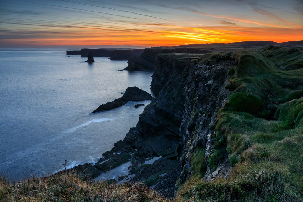
There’s no single official height for the Kilkee Cliffs, because they rise and fall along an 8 km stretch of coast. The best-documented landmark, Bishop’s Island, is a sea stack roughly 180 m by 90 m and about 65 m high, according to Kilkee Heritage. You’ll see 214 m (702 ft) quoted on a lot of websites (including, until now, this one), but that’s the height of the Cliffs of Moher.

What are the Kilkee Cliffs made of?
Not limestone. That’s the Burren further north. Kilkee’s cliffs are Upper Carboniferous sandstones, siltstones and shales, laid down around 300–320 million years ago at the edge of an ancient delta. Geologists call the cliff faces here the Tullig, Dunlickey and Kilkee cyclothems: repeating layers left by huge rises and falls in sea level. That’s the stratification I learned about in grade 8, on a scale you can’t get from a textbook. The Geological Society of London also lists Kilkee’s “sand volcanoes” (small cones formed as water squeezed out of wet sediment) among its 100 Great Geosites.
How Long Is the Kilkee Cliff Walk? Routes & Distances
All routes start and finish at the Diamond Rocks car park, and all of them reach the main viewpoint looking up and down the coast and across the Shannon Estuary to Kerry.
| Route | Distance | Time | What to expect |
| Short cliff walk | 1.8 km | 30 min | Asphalt path all the way; steep incline for the last 200 m; cliff edge on one side |
| Short loop | 4 km | 50–60 min | Cliff path, then Dunlicky Road back into town; one steep climb of about 100 m |
| Classic loop | 8 km | 2–3 hrs | Past Intrinsic Bay, then right along the coast and down Moveen Hill into Kilkee |
| Long route | 11.7 km | About 2.5 hrs+ | Asphalt path then quiet road, with views up and down the coast; extends towards Bishop’s Island and Dunlicky |
You’ll see the short loop quoted as 4 km or 5 km depending on where people start measuring. It’s the same walk. Plenty of walkers skip the inland road sections and walk the cliff path out and back instead, which gives you the best views twice.
Walking Directions: How to Find the Puffing Hole, the Amphitheatre and Other Hidden Features
Most of the best features on the Kilkee Cliffs aren’t on Google Maps or signposted. You find them by knowing the order they come in. Start at the Diamond Rocks Café and head west, then south, along the cliff path, with the sea on your right.
1. The Pollock Holes (at the car park)
Stand in the Diamond Rocks / Pollock Holes car park and look down at the flat rock shelf below. That’s Duggerna Reef, and the pools in it are the Pollock Holes. At low tide you can walk across the flagstones to them; the pools are 1 to 2.5 metres deep and 20–50 metres across (Discover Ireland). At high tide they vanish under the sea.
2. The Diamond Rocks (beside the café)
The rocks around the café and the start of the path are veined with quartz. Look closely on a sunny day and they glitter, which is where the name comes from.
3. The Amphitheatre (below the path, early on the walk)
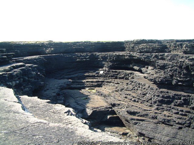
Keep going along the tarmac path past the café and look down over the edge on the sea side. The Amphitheatre is a curved bowl in the rock where the waves have cut the sandstone layers into tier upon tier of ledges, like seats in an open-air theatre (Clare Library). There’s no sign. Look for a horseshoe-shaped hollow with stepped rock ledges running around it. The Pink Caves are along this same stretch.
4. The Puffing Hole (between the Amphitheatre and Intrinsic Bay)
Carry on along the cliff path after the Amphitheatre. The Puffing Hole is a natural blowhole: when a wave rushes into the cave underneath, air and water are forced up and out in a burst of spray. You’ll usually hear it before you see it, a deep boom or whoosh, so listen as you go. It’s at its best at high tide in a big swell. On a calm day at low tide it may do nothing at all. If you’ve reached Intrinsic Bay, you’ve passed it.
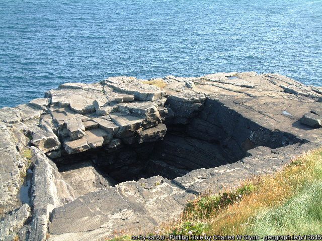
5. Intrinsic Bay (before the steep climb)
The path curves around a deep inlet with sheer walls. This is Intrinsic Bay, where the Intrinsic was wrecked in 1836. Right after the bay comes the steep 200 m climb. The Pollock Holes, Diamond Rocks, Amphitheatre and Puffing Hole all come before this climb, which is good news if you can only manage the gentler first stretch.

6. Look Out Hill, Foonagh Bay and the coast road
At the top of the climb the path meets Dunlicky Road. Turn left for the short loop back to town, or right to carry on along the coast past Foonagh Bay and Look Out Hill, with its views back over Kilkee. The 8 km loop comes back down Moveen Hill.
7. Bishop’s Island, St Kee’s Well and Dunlicky Castle (longer routes and the coast road)
Further south, on the 11.7 km route or by car, you reach the Bishop’s Island viewpoint. St Kee’s Well is a small white structure in a field on the landward side of the road, close to Bishop’s Island. The ruins of Dunlicky Castle walls and its sea caves are beyond.
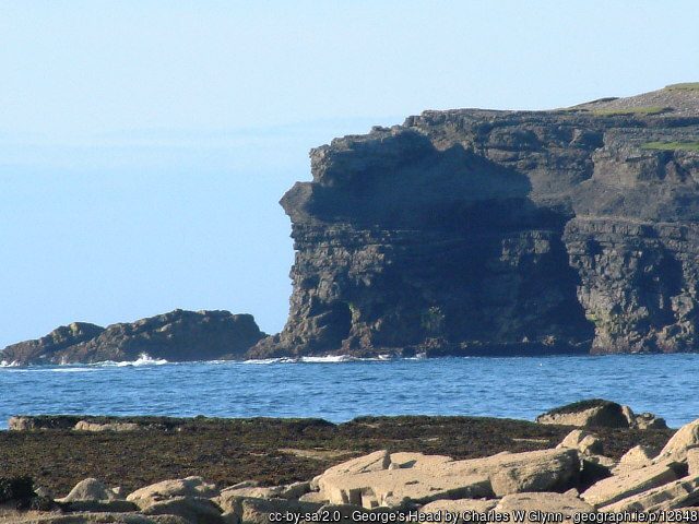
And across the bay: George’s Head
George’s Head is on the north side of Kilkee Bay, not on the cliff walk. It’s a separate short walk from the north end of the promenade and a good spot for watching waves hit the cliffs.
Kilkee Cliffs Map
The simplest map is AllTrails’ Kilkee Cliff Walk route. Download it offline before you go, as phone signal is patchy on the Loop Head Peninsula. Ordnance Survey Discovery Series map 63 covers the whole peninsula.
Map of the Kilkee Cliffs walk and viewpoints. Open the full map in Google Maps
Kilkee Cliffs Parking
- Diamond Rocks / Pollock Holes car park: at the West End, right at the trailhead beside the café. It fills fast on sunny summer days, and some walkers report paid parking at peak times, so check the signs.
- Kilkee town: plenty of parking in town, and it’s a pleasant 10–15 minute walk along the promenade to the West End.
- Bishop’s Island viewpoint: a small roadside pull-in on the coast road south of town, with room for only about eight cars. Useful if you’re driving rather than walking.
Getting to Kilkee
Kilkee is roughly 2 hours’ drive from Galway and about 1.5 hours from Limerick. Shannon Airport is around 1.5 hours away.
By bus: Bus Éireann routes 333 (Ennis–Doonbeg–Kilkee) and 336 (Ennis–Kilrush–Kilkee) serve Kilkee from Ennis. Coming from Limerick, Galway or Shannon, change at Ennis. Check current times on buseireann.ie.
The Pollock Holes: Kilkee’s Natural Swimming Pools
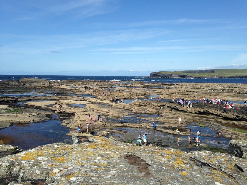
The Pollock Holes are natural rock pools on the flat reef at Kilkee’s West End, right below the Diamond Rocks Café. The Atlantic carved them out of the sandstone and shale shelf, they’re named after the pollock once commonly caught in them, and every tide refills them with clear seawater.
At low tide they become sheltered swimming pools, some deep enough for a proper dip. At high tide they disappear under the waves and the reef becomes dangerous. Go in calm summer weather. No ticket needed, just a check of the tide times.
Intrinsic Bay and the Wreck of the Intrinsic
Intrinsic Bay is named after the Intrinsic, a sailing ship out of Liverpool bound for New Orleans, which was driven onto the rocks here in a storm in January 1836. All 14 people on board were lost (Atlantic Way Touring). For more on the ships lost along this coast, see Irish Wrecks Online.
It wasn’t Kilkee’s worst shipwreck. In November 1850 the emigrant ship Edmond, sailing from Limerick to Quebec, was blown into Kilkee Bay and broke in two on the rocks at what is now called Edmond Point. Nearly a hundred people drowned (Clare Library).
Look down at the swell booming into the rocks and you can see how little chance a sailing ship had. The steepest part of the walk comes right after the bay: a climb of about 200 m that isn’t suitable for wheelchairs or buggies.

Bishop’s Island: The Monastery on a Sea Stack
Bishop’s Island, about 3 km southwest of Kilkee, is my favourite thing on this coast. It was joined to the mainland within the last thousand years, and on its flat top you can still see the ruins of an early Christian monastic settlement: a small dry-stone oratory, a clochán (beehive hut) and traces of up to four other buildings (Kilkee Heritage). It’s often linked to St Senan.
Its Irish name means “the island of the hungry bishop.” Local legend says a Bishop of Killaloe fled there to escape the plague. You can’t land on it, so you see it from the cliff path or the roadside pull-in. Bring binoculars.

Wildlife & Birdwatching
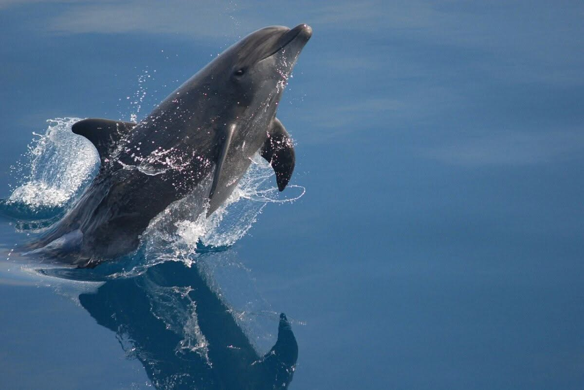
The cliffs are a good spot for birdwatching: look for fulmars, kittiwakes, choughs and peregrine falcons, and migrating shorebirds in winter. Out at sea, grey seals are common, the Shannon Estuary’s resident bottlenose dolphins are sometimes seen, and basking sharks pass in summer.
The reefs around Kilkee, including Bishop’s Island, are protected as the Kilkee Reefs Special Area of Conservation, and the seabird cliffs at the tip of the peninsula are a Special Protection Area.
Kilkee Beach, the Promenade and Town
Kilkee’s horseshoe beach on Moore Bay holds a Blue Flag for 2026, with lifeguards in the bathing season (1 June–15 September). The reef across the mouth of the bay keeps the water unusually sheltered for the Atlantic coast, which is why Kilkee has been a family seaside resort since Victorian times. Walk the promenade between the beach and the West End and you’ll pass the statue of actor Richard Harris, who spent childhood summers here.
Kilkee is also a base for surfing, kayaking, coasteering and diving (see “Things to Do” below).

Beyond Kilkee: Loop Head Peninsula
After your walk or drive, keep going southwest to Loop Head. The Kilkee Cliffs are only the start of this coastline.
Loop Head Lighthouse
Loop Head Lighthouse stands at the tip of the peninsula, about 30 minutes’ drive from Kilkee. There’s been a light here since 1670, and the current 23 m tower dates from 1854. On a clear day you can see from the Blasket Islands to Connemara.
- 2026 season: reopened 14 March; weekends and bank holidays in March, April and October (until 26 October), daily 10am–5pm from 2 May to 27 September.
- 2026 prices: grounds and exhibition €3 adults, free for under-18s; the guided tower tour is an extra €5 for adults and children, €3 for over-65s and students.
- Access: the tower (74 steps) is not suitable for wheelchair users or anyone with a fear of heights. The exhibition, toilets and coffee dock are wheelchair accessible. Free parking.

Cliffs of Campoy, Bridges of Ross and Kilbaha
Walk right from the lighthouse car park and you’ll reach the Cliffs of Campoy. Behind the lighthouse is a sea stack and the wartime “ÉIRE” sign. On the north side of the peninsula, the Bridges of Ross is a natural sea arch (there were once three) and a famous autumn seabird-watching spot. Kilbaha, the last village before the head, has its own cliffs and a gallery. Dolphin-watching boat trips run from Carrigaholt on the Shannon side.

Accessibility at Kilkee Cliffs: Seeing the Cliffs With Limited Mobility
I have walking and mobility issues, and I saw the Kilkee Cliffs from four viewpoints rather than walking the trail: the Diamond Rocks car park, the coast road, the Bishop’s Island pull-in and Loop Head. Between them, you get the whole story of this coast without a hike. Kilkee is one of the easier dramatic coastlines in Ireland to enjoy with limited mobility, easier than the Cliffs of Moher in some ways, because a quiet road runs right beside the cliffs and there’s no long walk from a visitor centre.
Accessibility at a glance
| Feature | What to expect |
| Cost | Free, with no ticket and no timed entry |
| Parking | Diamond Rocks / Pollock Holes car park at the trailhead; town parking; small roadside pull-ins on the coast road |
| Path surface | Tarmac from Diamond Rocks along the first stretch of cliff path |
| Gradient | Short climb at the start; steep 200 m incline at the end of the 1.8 km route and again after Intrinsic Bay |
| Handrail | A rail on the steepest parts of the path |
| Seating | Benches along the path at viewpoints |
| Barriers | Largely unfenced cliff edge |
| Drive-up views | Yes, the coast road south of Kilkee runs beside the cliffs |
Option 1: The viewpoints from the car
This is how I did it. If walking any distance is hard, drive. The coast road heading south from Kilkee’s West End towards Dunlicky runs close to the cliff edge for several kilometres, with pull-ins where you can stop, open the door and take in the view. Don’t miss the small pull-in above Bishop’s Island (room for about eight cars). You look straight across at the sea stack and its monastery ruins without leaving the tarmac, and it was one of my favourite stops. Go slowly: it’s a narrow, quiet road, and there are more views than signed stopping places.

Option 2: The short, gentle stretch from Diamond Rocks
The Diamond Rocks car park was my first viewpoint. From here you can see the Pollock Holes and the bay without walking at all. If you can manage a little, the first section of cliff path beyond the café is tarmac, with benches, so you can go as far as is comfortable, sit, and turn back. The steep parts come later, so you don’t need to reach the main viewpoint to see something spectacular.
Option 3: Loop Head Lighthouse
I finished at Loop Head, and it’s well worth the extra 30 minutes’ drive. At Loop Head Lighthouse the exhibition, toilets and coffee dock are wheelchair accessible, and parking is free and close by. The tower tour (74 steps) isn’t suitable for wheelchair users or visitors with reduced mobility, but the grounds give you wide-open Atlantic views right beside the car park.

Tips for visitors with limited mobility
- Pick a calm day. The wind is fierce and can make balance difficult even on flat tarmac. Mornings are usually calmer.
- Arrive early in summer to get a space in the Diamond Rocks car park, which fills fast on sunny days.
- Bring a walking aid or folding seat if you use one. There are benches, but they’re spaced out.
- Wear grippy shoes. Tarmac and grass get slick when wet.
- Keep back from the edge when you stop on the verges. Most of it is unfenced.
For more ideas, see my guide to accessible Ireland.
Safety & Seasonal Tips
- Unfenced edges: most of the cliff top has no barriers. Stay on the path and keep well back, especially with children, dogs and cameras.
- Wind: the cliffs are fully exposed. Go early to avoid afternoon winds, and skip the cliff path when there’s a storm warning.
- Tides: the Pollock Holes are only safe at low tide. Check Kilkee tide times or Loop Head tide tables before you go.
- Winter: short daylight hours, and the grass verges get muddy and slippery.
- Best time: early morning or sunset for the light; low tide for the Pollock Holes; May–September for the lighthouse.
Things to Do in Kilkee: Food & Activities
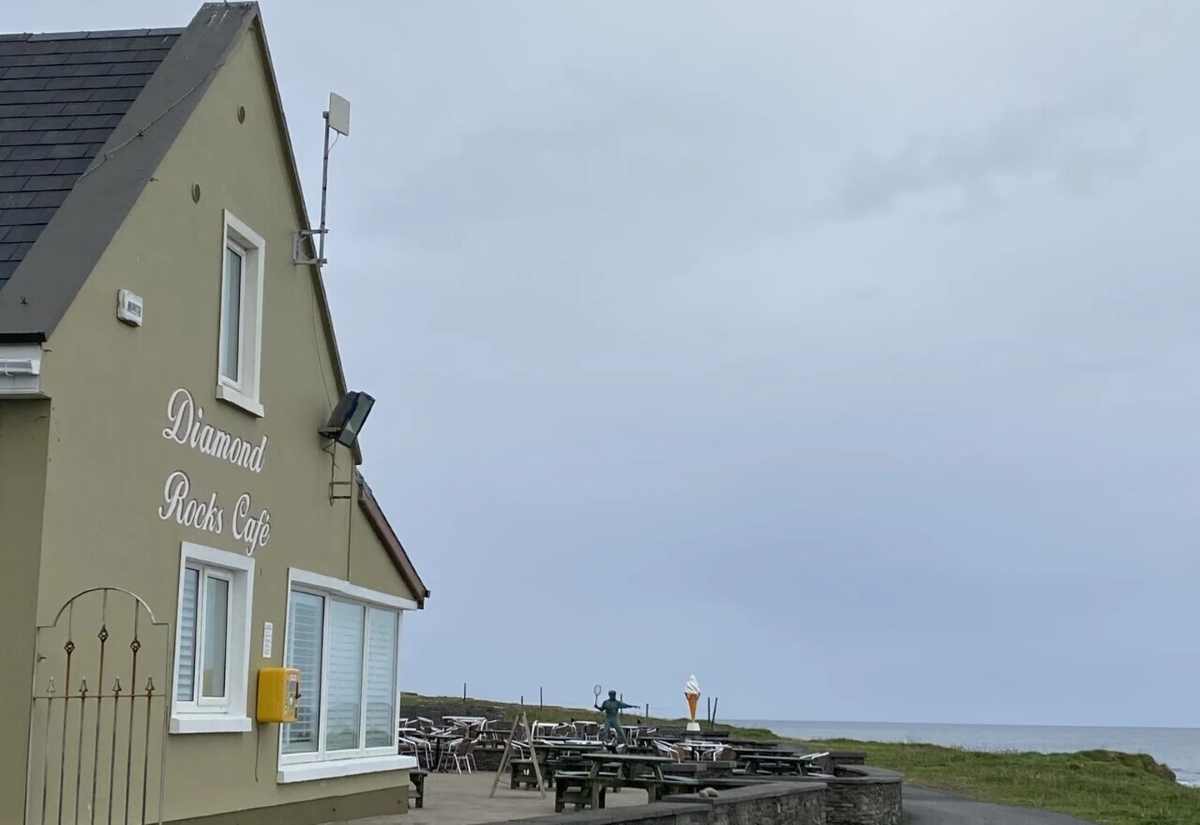
Diamond Rocks Café: a family-run café right on the cliff walk, with sea views, traditional Irish food and seafood including fish and chips. Start or finish here.

Nevsail Watersports: individual and group activity packages from its Kilkee centre, including coasteering, one of the best ways to see the cliffs from sea level.
Ocean Life Kilkee: a dive centre for qualified divers, with sites ranging from sheer walls and sheltered reefs to caverns and kelp forests. Kilkee has a long diving reputation, and it’s often said that Jacques Cousteau rated it among Europe’s best dive spots.
Loop Head Walking Tours: local guided walks covering the peninsula’s geology and wildlife.

More of Clare and the Wild Atlantic Way
- Things to do in County Clare
- The Cliffs of Moher
- Exploring the Burren
- The Wild Atlantic Way route
- Best things to do in Kerry
- Ireland itineraries
Kilkee Cliffs FAQ
How high are the Kilkee Cliffs?
There’s no single official height; they vary along an 8 km stretch. Bishop’s Island, the best-known sea stack, is about 65 m high. The 214 m figure seen online belongs to the Cliffs of Moher.
Where is the Puffing Hole in Kilkee?
On the Kilkee Cliff Walk, after the Amphitheatre and before Intrinsic Bay. It isn’t signposted or on Google Maps. Listen for the boom of the blowhole, and go at high tide in a swell for the best show.

Where is the Amphitheatre in Kilkee?
Below the cliff path, early on the walk from the Diamond Rocks Café. Look down on the sea side for a horseshoe-shaped hollow with tiered, seat-like rock ledges.
How long is the Kilkee Cliff Walk?
There are four routes from Diamond Rocks: 1.8 km (30 minutes), a 4 km loop (under an hour), an 8 km loop (2–3 hours) and an 11.7 km long route.
Where do you park for the Kilkee Cliff Walk?
At the Diamond Rocks / Pollock Holes car park in Kilkee’s West End, at the trailhead. It fills up on summer days, so park in town and walk along the promenade if it’s full.
Is the Kilkee Cliff Walk free?
Yes. There’s no admission charge, and the walk is open all year.
Is the Kilkee Cliff Walk suitable for wheelchairs or buggies?
Partly. The first section from Diamond Rocks is tarmac with benches, but the short route ends on a steep 200 m incline and the climb after Intrinsic Bay isn’t suitable for wheelchairs or buggies.
Can you see the Kilkee Cliffs without walking?
Yes. You can see the Pollock Holes and bay from the Diamond Rocks car park, and the coast road south of Kilkee runs beside the cliffs with pull-ins, including one overlooking Bishop’s Island.
Are the Kilkee Cliffs better than the Cliffs of Moher?
They’re lower, but free, quieter and more varied, with tidal pools, a shipwreck bay and Bishop’s Island. If you dislike crowds, Kilkee is the better choice.
When can you swim in the Pollock Holes?
Only at low tide in calm weather. At high tide the pools are covered by the sea and the reef is dangerous.

Can you bring a dog on the Kilkee Cliff Walk?
Yes, dogs are welcome. Keep them on a lead, as the cliff edge is unfenced.
How far is Loop Head from Kilkee?
About 30 minutes’ drive southwest. Loop Head Lighthouse is open from mid-March to late October in 2026.
Final Thoughts
Kilkee doesn’t get the coach tours, and that’s exactly why I’d send you there. Go on a calm morning, take the coast road slowly, stop at Bishop’s Island, and look closely at those layered cliffs. If you were ever a kid who loved rocks, they’ll bring it all back.
Join 7,500 Ireland travellers in my Ireland Uncovered Facebook Group and 1,897 on my XYUandBEYOND PAGE
Start Planning Your Trip
👉 Public Transportation in Ireland
👉 Hidden Gems in Ireland – 32 Secret places to visit
👉 Answering all your travel questions about Ireland